Narsingdi travel guide, Dhaka Division
Narsingdi lies about 50 km north-east of Dhaka, with the Meghna, Shitalakshya and Old Brahmaputra rivers along its borders. It is known for its textile and weaving industry and for Wari-Bateshwar in Belabo, an archaeological site where excavations have uncovered the remains of a very old fortified urban settlement. About 2.58 million people live in its roughly 1,150 km² (2022 census).
Sources: Wikipedia: Narsingdi District, Wikipedia: List of districts of Bangladesh (area, 2022 census) · facts checked Oct 7, 2026
At a glance
- Division
- Dhaka Division
- Area
- 1,150 km²
- Population (2022 census)
- 2,584,452
- Density
- 2,247 people per km²
Sources: Wikipedia: List of districts of Bangladesh (area, 2022 census) · facts checked Oct 7, 2026
Places to see
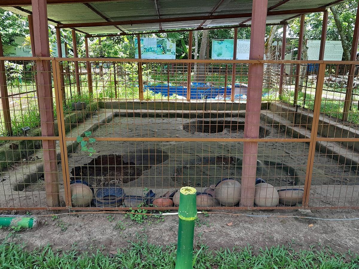
Wari-Bateshwar
An archaeological site in Belabo, Narsingdi, with the remains of an ancient fortified settlement.
Photo: Redmin / Wikimedia Commons · CC BY-SA 4.0 · Source
NarsingdiTravel facts
- Best time to visit
- No verified information yet
- Estimated costs
- No verified information yet
FAQ
Where is Narsingdi?
Narsingdi is in Bangladesh's Dhaka Division, one of the country's 64 districts.
What is there to see in Narsingdi?
Places added to this guide: Parulia Shahi Mosque, Wari-Bateshwar.
When is the best time to visit Narsingdi?
We don't have verified information on this yet, so no months are given.
What is Wari-Bateshwar?
An archaeological site in Belabo upazila where excavations have revealed the remains of an ancient fortified urban settlement.
What is Narsingdi known for?
Its textile and weaving industry, and the Wari-Bateshwar archaeological site.